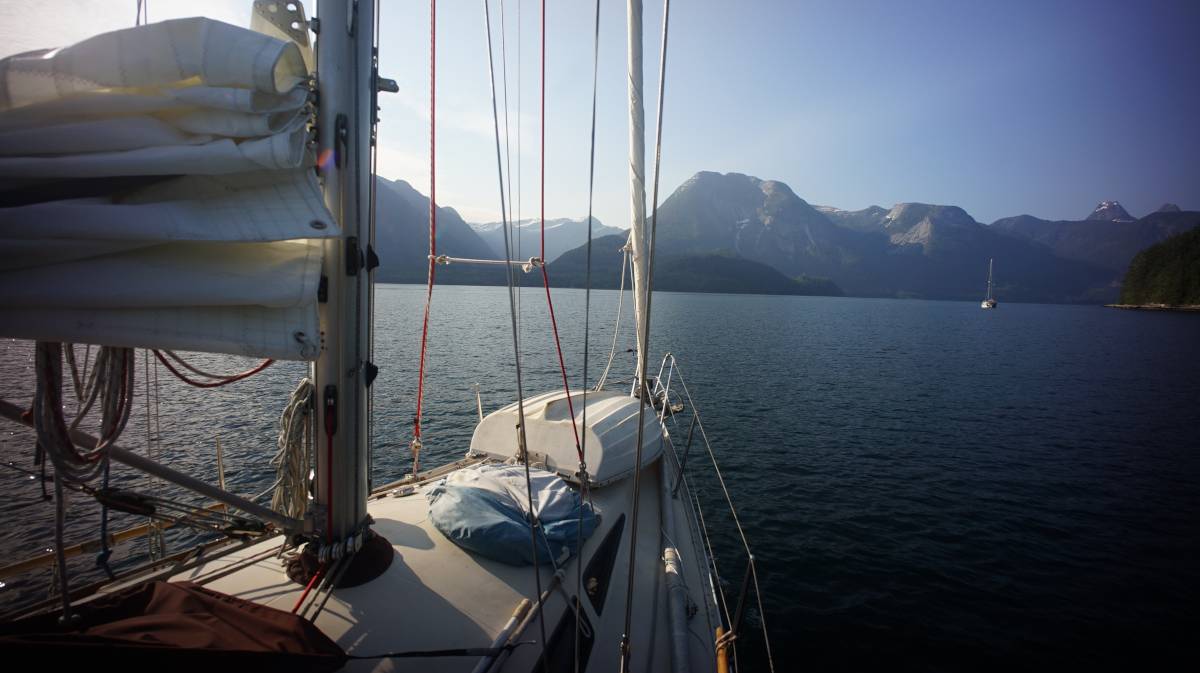
western canada
We bought Pino in North Saanich, British Columbia, Canada in 2016. We left in August 2016 to circumnavigate the Pacific Ocean. We returned to our home waters in August 2020 after our north pacific ocean crossing from Japan.
- Currents and Tides Resources
- Wind and Weather Resources
- Books About Anchorages
- Our Summer Sailing Routes
- Our Cruising Notes

Tide and Current Resources
The tide and current situation makes it tricky to sail in BC, but there are many resources to make it easier to safely plan a sail. Always refer to the CHS Current and Tide Tables[1] and/or Ports and Passes Tides and Tables[2] when going through high-current passes like Dodd's Narrows, Porlier Pass or more dangerous rapids like Seymour Narrows and Malibu Rapids.
The Canadian Hydrographic Service also has a Current Atlas[3] in print that makes it easier to visualize how the current moves between the numerous islands populating the Salish Sea(Strait of Georgia and Juan de Fuca Strait). Looking up the month, day, and time in the Current Atlas Tables[4] will indicate the correct current chart to refer to in the Current Atlas.
[1] Tide and Current Tables (published by the Canadian Hydrographic Service)
Available here. Volume 5, 6 and 7 cover the entire Canadian West Coast. Released in January every year. Adjust for daylight savings time, being an hour off when transiting a rapid can be very dangerous.
[2] Ports and Passes
Tide and current guide, similar to the CHS tables, covering Puget Sound, BC, and SE Alaska. Contains local knowledge, and how to use secondary tables to calculate tides and currents at any secondary station.
[3] Current Atlas - Juan de Fuca Strait to Strait of Georgia (published by the Canadian Hydrographic Service)
Available here. Used in conjunction with Vol.5 of the Tide and Current Tables and/or the list of tables listed below(washburne, murray's, borsboom & ports and passes). This book contains diagrams illustrating where to expect strong tidal streams or large eddies, as well as surface currents caused by the discharge of the Fraser River. Keep the same copy forever. The atlas explains how to use secondary tables to calculate tides and currents at any secondary station
[4] Current Atlas Reference Tables
- Murray's Tables(sold in Canadian Marine Stores)
- Ports and Passes Current Atlas Tables (sold in Canadian and US Marine Stores, formerly Washburne's Tables)
- Borsboom's Tables (digital)
Disclaimer: We've used these tables for the past 2 years, predicted conditions matched the current we encountered, but we haven't compared it to other tables. Use at your own risk.
Use these tables to quickly determine which chart of the Current Atlas - Juan de Fuca Strait to Strait of Georgia to consult to reference when planning a sail. Released in January every year.
[5] Salish Sea Nemo Model Daily Results (A UBC project)
Models of tidal predictions in the Salish Sea, with visualizations.
Wind and Weather Resources
To sail the Inside Passage waters don't use tools like Windy or Predict Wind, the geography of this coast is complex, it affects the wind in curious ways that are not reflected in their predictions.
For more accurate wind forecasts, look at the conditions reported by specific buoys, automated stations and lighthouses scattered along the coast[5,6 and 7](click on the Weather Conditions tab and select the desired buoy or land station). To learn how land affects these waters(inflow/outflow winds, cape effects, sea breezes etc), read books by local authors like Marilyn Johnson[8].
- Metport
A detailed, marine-focused weather prediction portal for the Juan de Fuca Strait and for Georgia Strait, with frequently updated visualizations. - [5]Pacific Georgia Basin. Wind and weather forecasts for the Pacific Georgia Basin.
- [6]Pacific North Coast. Wind and weather forecasts for the Pacific North Coast.
- [7]Pacific South Coast. Wind and weather forecasts for the Pacific South Coast.
- [8]Taken by the Wind: The Northwest Coast by Marilyn Johnson.
Books About Anchorages
- Waggoner Guide (1 volume that covers BC, SE Alaska, and Washington).
- Dreamspeaker Series (4 volumes covering The Broughtons, Desolation Sound/Discovery Passage, Gulf Islands and Vancouver/Sunshine Coast).
- Exploring the North Coast of BC (Bluden Harbour to Dixon Entrance).
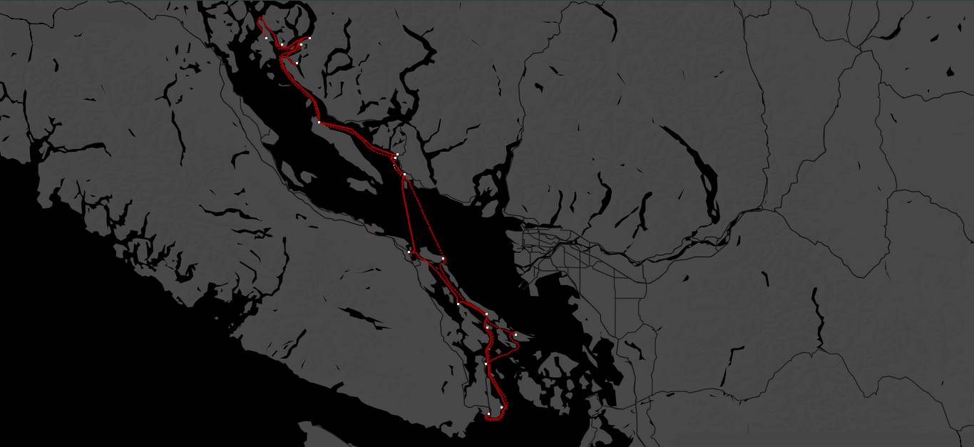
Our Summer Sailing Routes
Since 2020 we've spent our winters on the Victoria docks, and summers cruising in the Salish Sea. Dotted lines indicate the return trip, with some overlap with the starting routes.
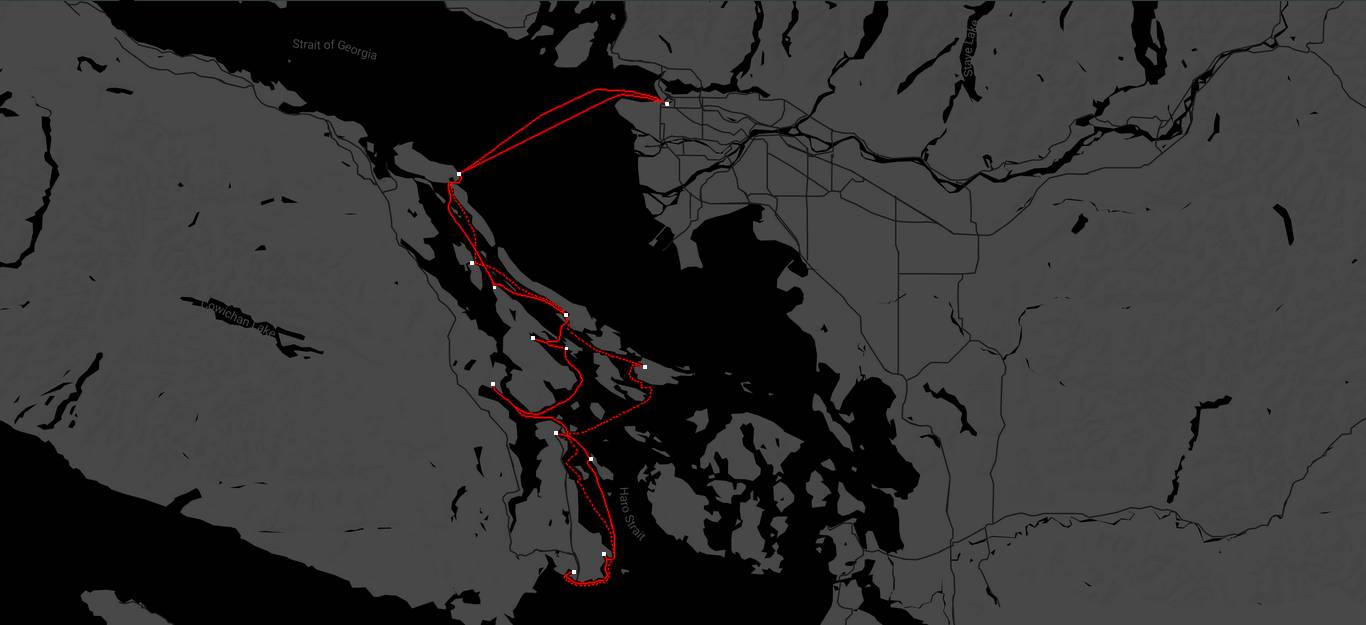
Summer 2021 route: Victoria > Cadboro Bay > North Saanich > Wesport Boatyard > Genoa Bay > Glenthorne Passage > Ganges(SaltSpring Island) > Montague (Galiano) > Southey Bay > Gabriola > False Creek(Vancouver) > Gabriola > Clam Bay > Montague Harbour(Galiano) > Lyall Harbour (Saturna Island) > North Saanich > Victoria. Note. We had engine problems that year, so we didn't cruise around too much. See engine rebuild. We also did a lot of boat projects, like installing our woodstove, our dry toilet and dealing with thruhulls.
Summer 2022 route: Victoria > Sidney > Glenthorne Passage (Prevost Island) > Montague (Galiano) > North Cove (Thetis Island) > Nanaimo > Secret Cove > Pender Harbour > sturt bay Texada Island > Grace harbour > Melanie Cove > Refuge Cove > hathayim marine park > Melanie Cove > Tenedos Bay > Sturt Bay > Bargain Bay (Setchel Peninsula > Gabriola (Silva Bay) > Montague (Galiano) > Lyall Harbour (Saturna Island) > Sidney > Montague (Galiano) > Sidney > Cadboro Bay > Victoria.
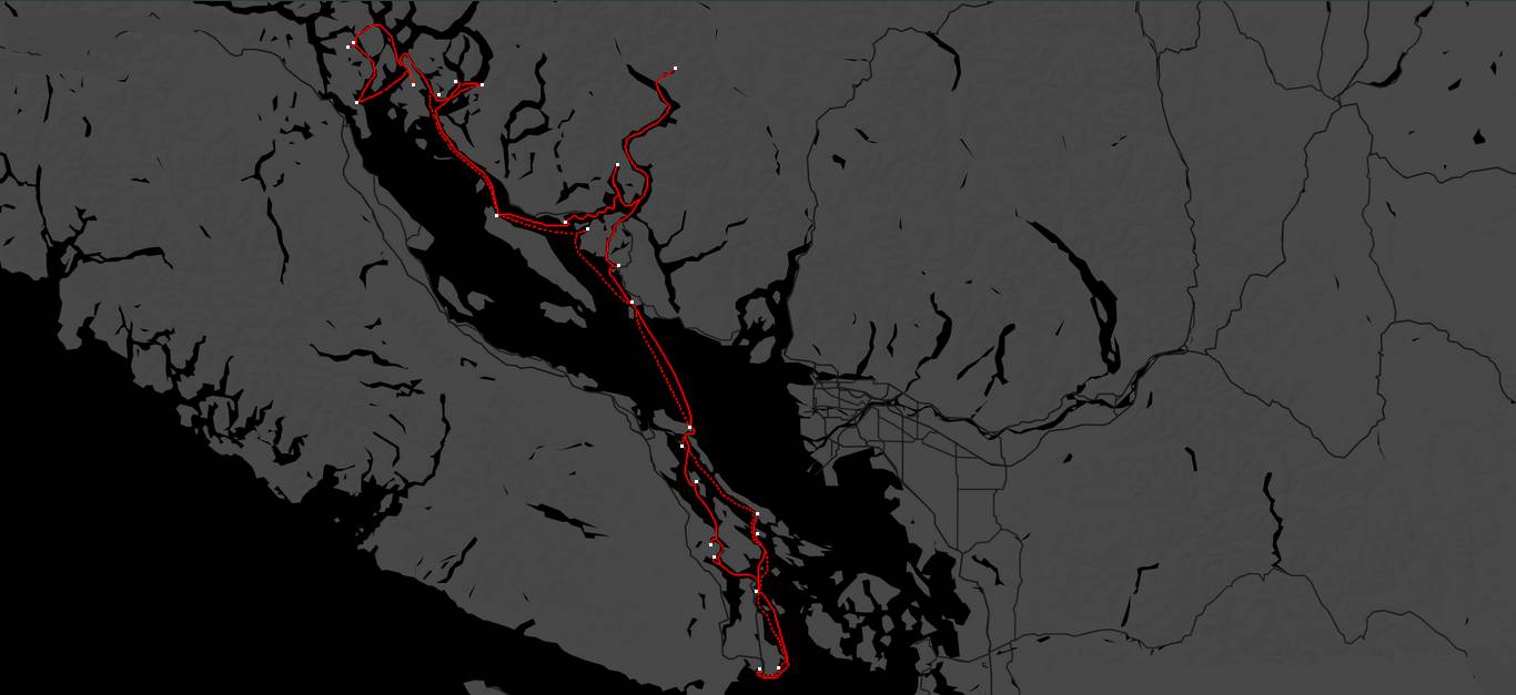
Summer 2023 route: Victoria > North Saanich > Glenthorne Passage (Prevost Island) > Montague (Galiano) > Glenthorne Passage > Westport Boatyard > Genoa Bay > Maple Bay > Telegraph Cove (Thetis Island) > Gabriola (Silva Bay) > Smuggler Cove (Setchel Peninsula) > Pender Harbour > Princess Louisa Inlet > Baker Bay (Hotham Sound) > Thunder Bay > Sturt Bay (Texada Island) > Roscoe Bay (West Redonda Island) > Melanie Cove > hathayim marine park > Heriot Bay > Octopus Islands > Waiatt Bay > Octopus Islands > hathayim marine park > sturt bay > Ballet Bay (Nelson Island) > Smuggler Cove > Gabriola > DeCourcey Island(SE anchorage) > Montague Harbour Galiano > Glenthorne Passage > Sidney > Oak Bay > Victoria.
Our Cruising Notes
Everytime we visit a new place, we'll update our notes here:
Gulf Islands
The Sunshine Coast
- Cathedral Grove
- Sturt Bay(Texada Island)
- Smuggler Cove
- Princess Louisa Inlet
- Ballet Bay
Desolation Sound
Discovery Islands
- Octopus Islands
- Heriot Bay
- Hathayim Marine Park(Von Donop inlet, Cortes Island)